Railway modelling is full of “what-ifs”, and here is mine!
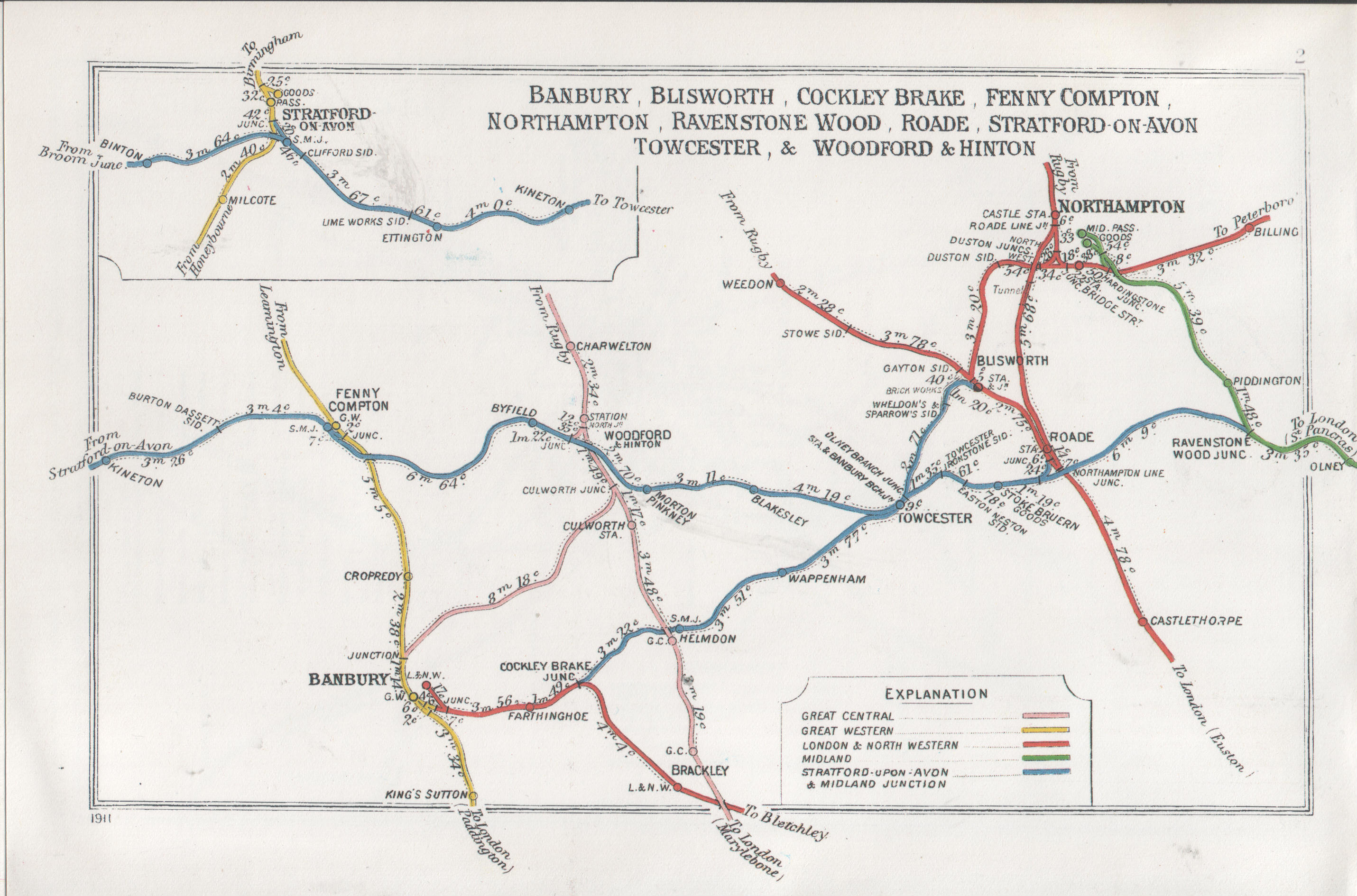
To start, the Railway Clearing House map of the area after the formation of the SMJR:
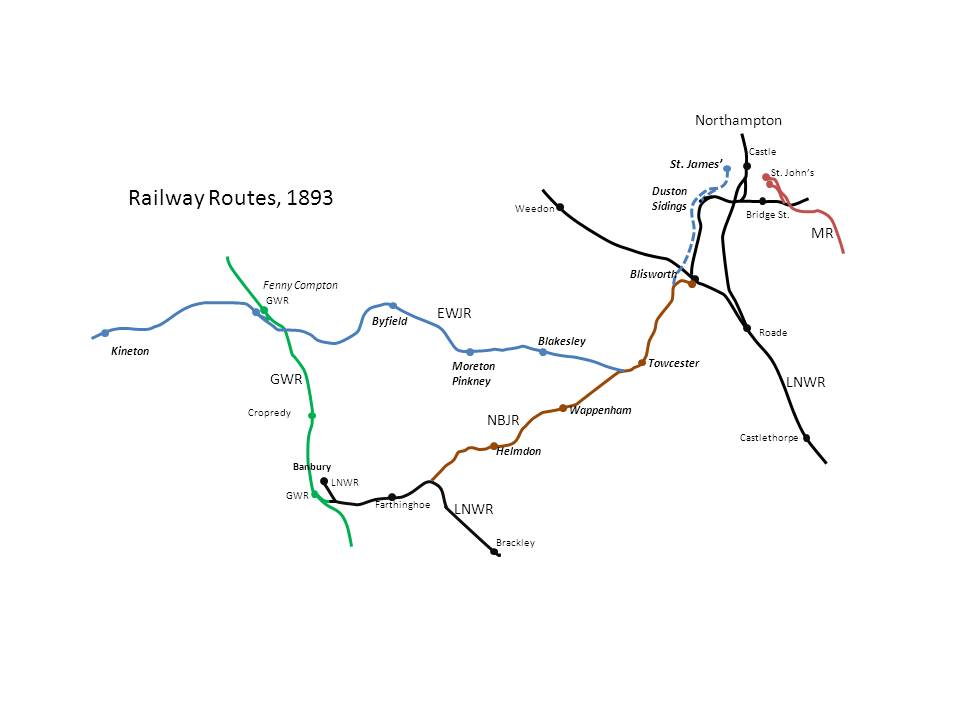
The East and West Junction Railway, desirous of gaining more iron ore traffic over its metals, obtained an Act of Parliament in 1888 which enabled it to build a single line over the LNWR just north of Blisworth, to connect with the LNWR Northampton and Peterborough branch between Courteenhall and Rothersthorpe, and to use running powers thence into Northampton Bridge Street. Unfortunately, satisfactory terms for this could not be agreed, and a subsequent Act was granted to enable the EWJR to build its own line to Northampton. During the surveying stage, it became apparent that the cost of making an end-on connection to the Midland at St. John’s station was going to be prohibitive: the line would need to be carried acros the flood plain on a viaduct of sufficient height to carry it clear of the LNWR line to Roade which was by then well under construction, and the LNWR were very likely to mobilise their considerable forces against the proposal. As the Midland had recently had a bruising session over the Settle – Carlisle route which they could hardly afford to build, it was disinclined to support the EWJR in a parliamentary battle and indeed to cough up any of the “necessary”. In the end the proposals were scaled down to a simpler (and more affordable!) scheme involving exchange sidings with the LNWR (and via running powers, the Midland) to the west of Duston West signal cabin, and a terminus in the St. James area of western Northampton – just over the river from the LNWR at Castle Station. With this line built, there was no need for an extension to Ravenstone Wood, either, so that line was never built.
The re-imagined network in 1893 looked something like this: